

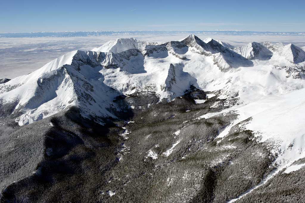
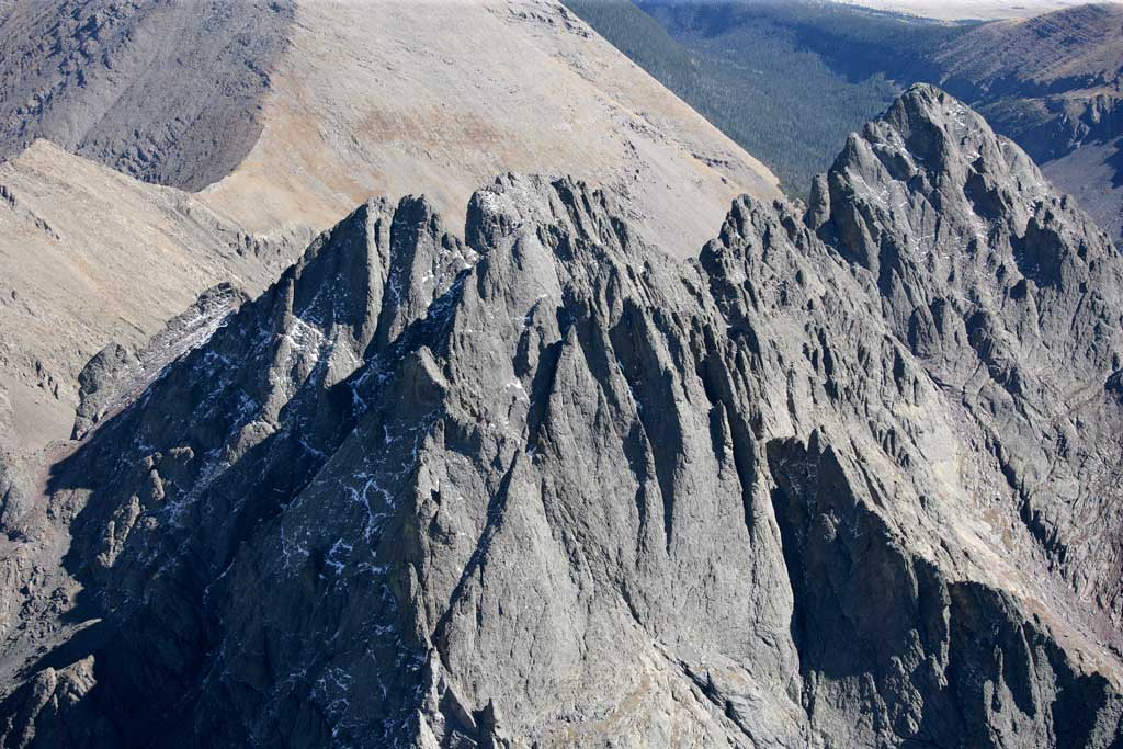
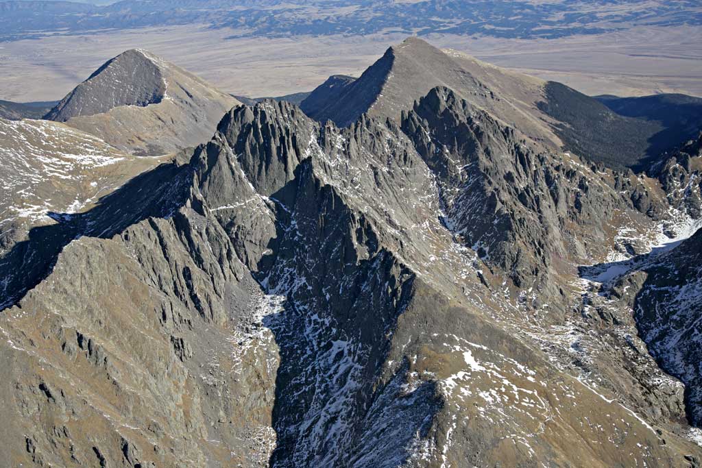
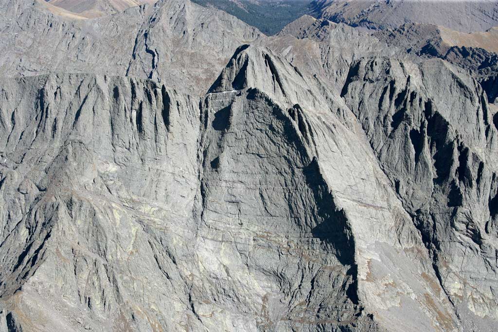
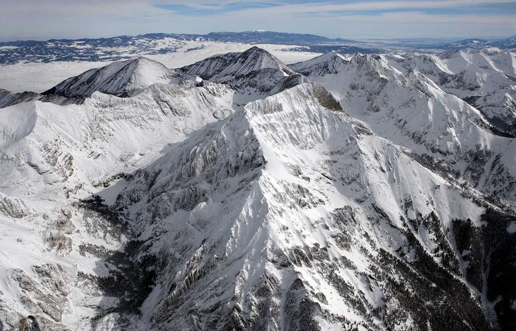
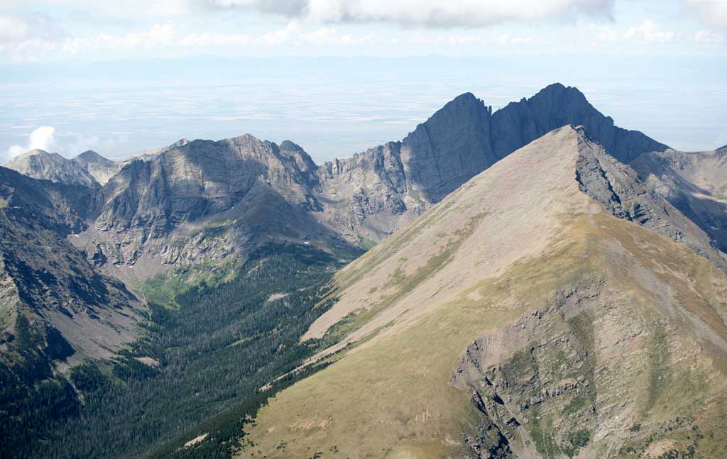
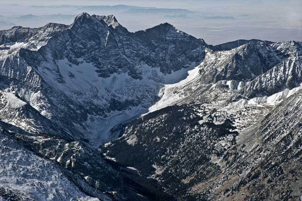
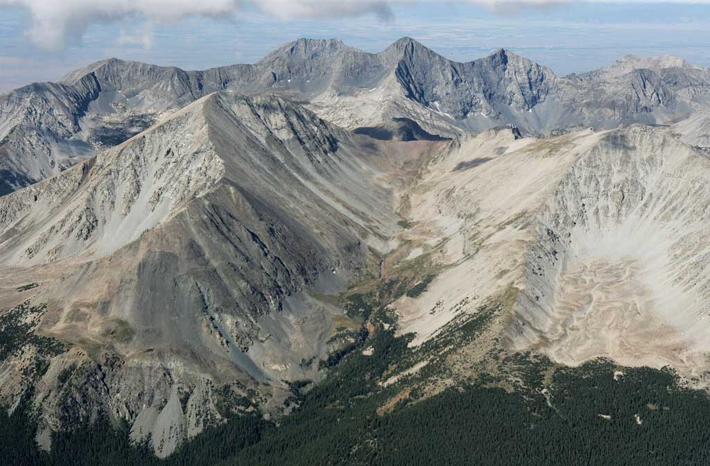
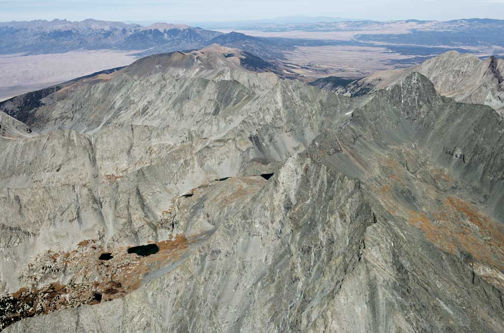
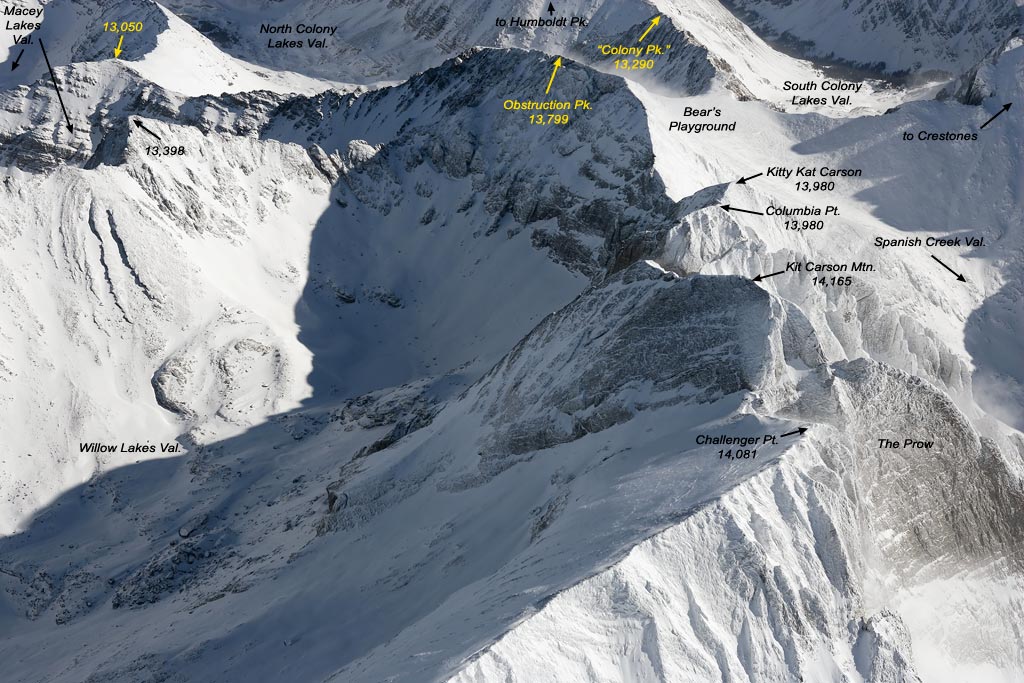
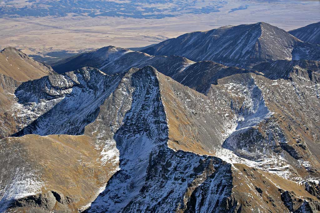
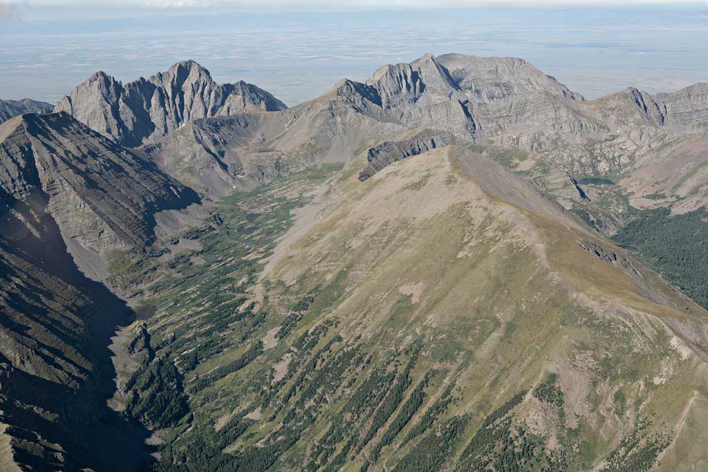
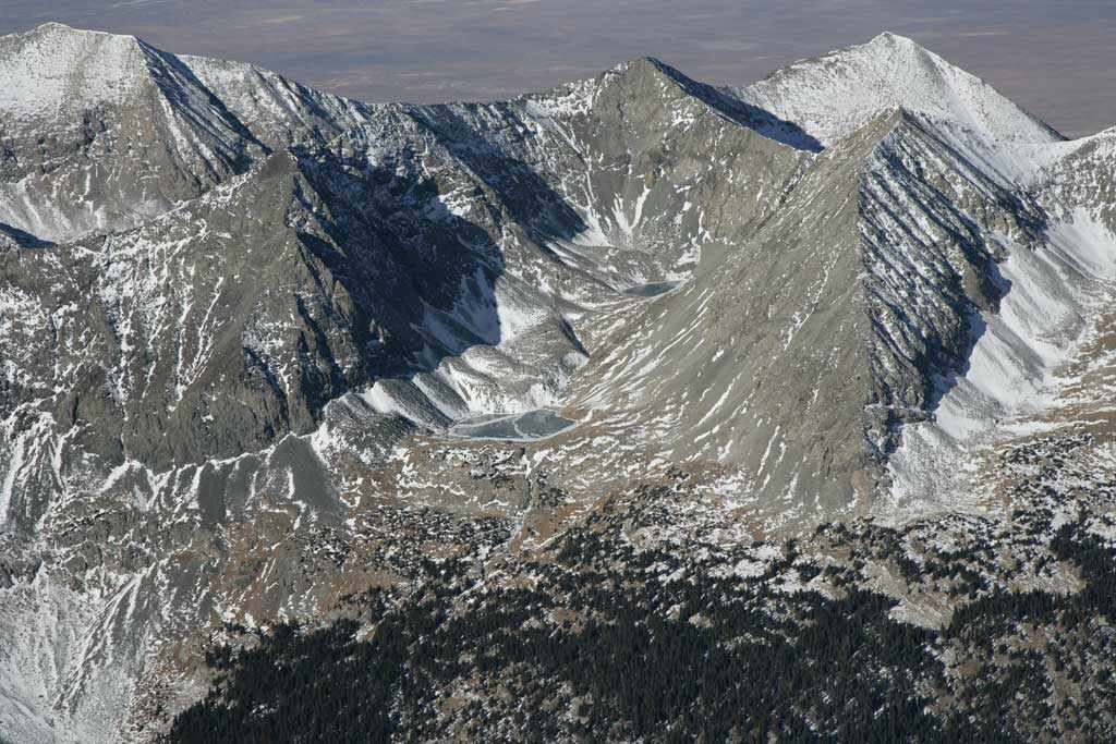
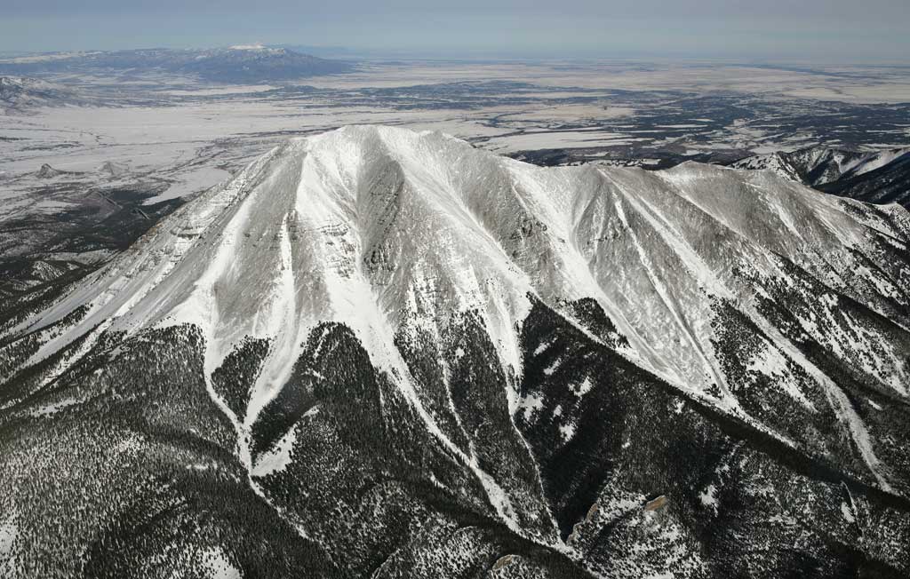
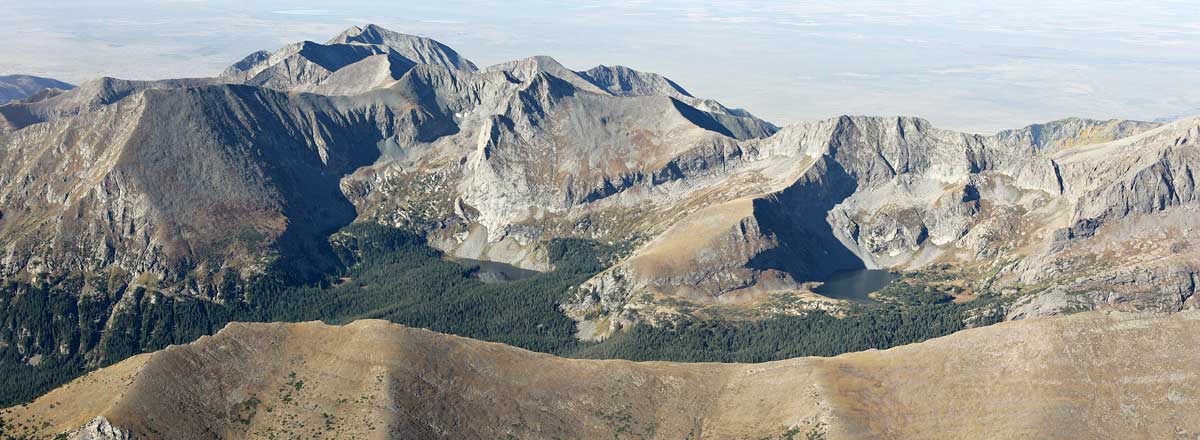
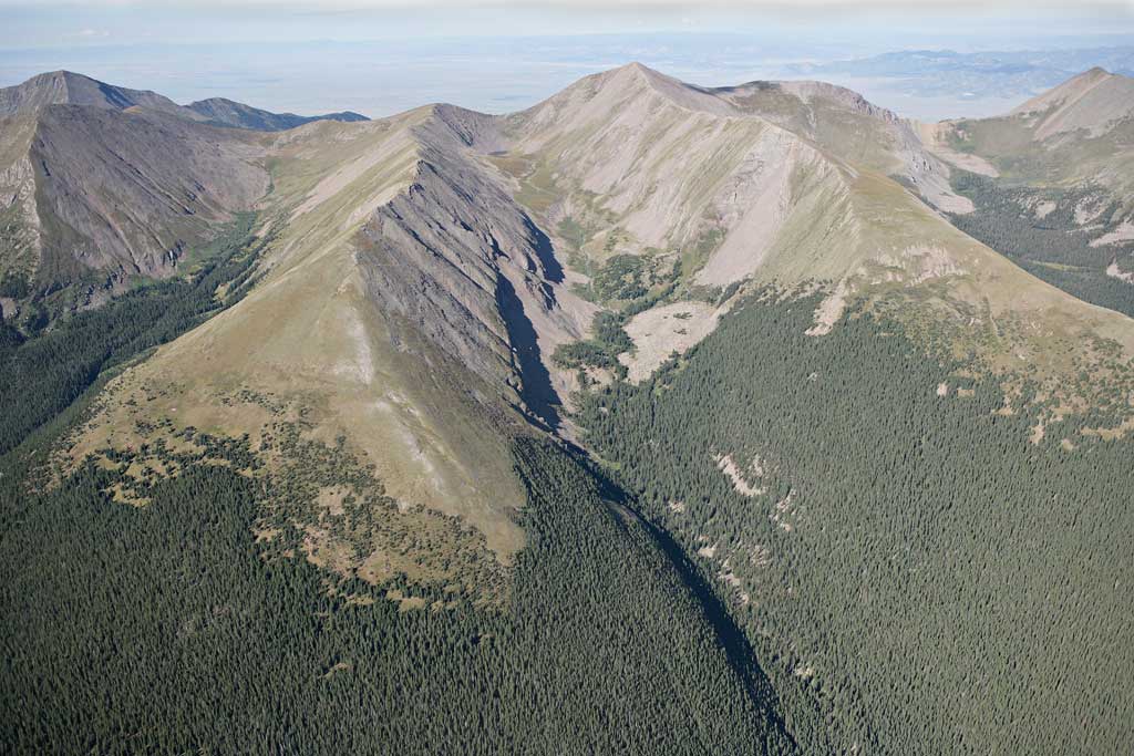
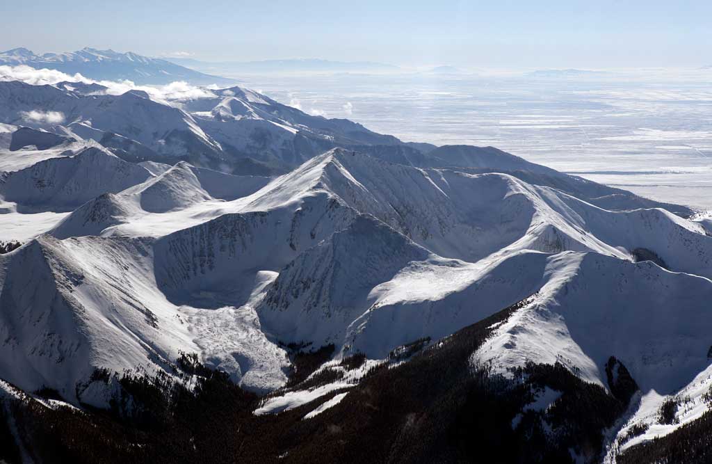
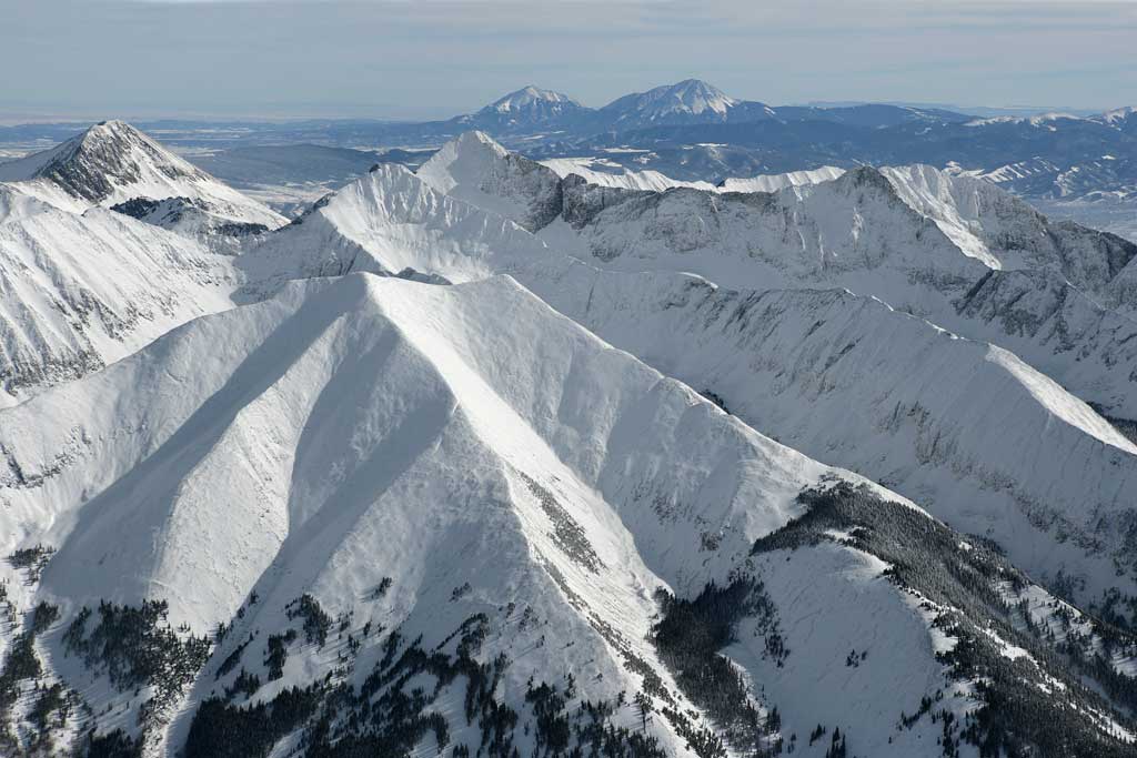
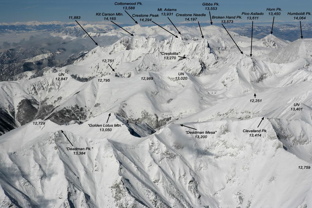
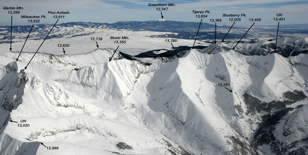
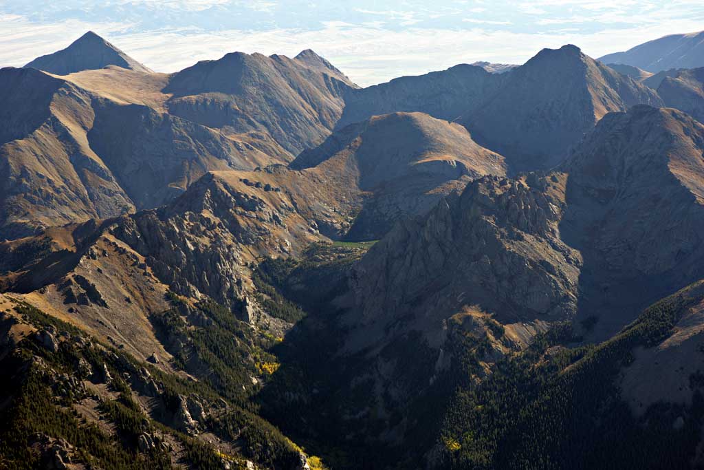
Top Mountains of the Sangre de Cristo Range
over 13,000 Feet High with aerial photographs and GPS coordinatesTo view the topographic map or satellite image use the link below and modify the coordinates (this one shows Blanca Massif):
http://www.stereoscopie.fr/php/showonmap.php?coords=-105.486,37.578&l=EN
Note: the Table lists only real peaks, with prominence not less than 300 feet. A value of 300' is the separation limit that distinguishes peaks from sub-peaks in Colorado. The prominence or primary factor of a mountain is the minimal vertical drop from its summit before it ascends into a higher peak. Abbreviation "UN" stands for an Unnamed peak or mountain. Names in "quotes" are not officially recognized.
Rank |
Name |
Elevation Feet / Meters |
Links to web page, photograph |
Coordinates longitude, latitude |
1 |
Blanca Peak |
14345 / 4372 |
-105.486 , 37.578 | |
2 |
Crestone Peak |
14294 / 4357 |
-105.586 , 37.967 | |
3 |
Crestone Needle |
14197 / 4327 |
-105.576 , 37.965 | |
4 |
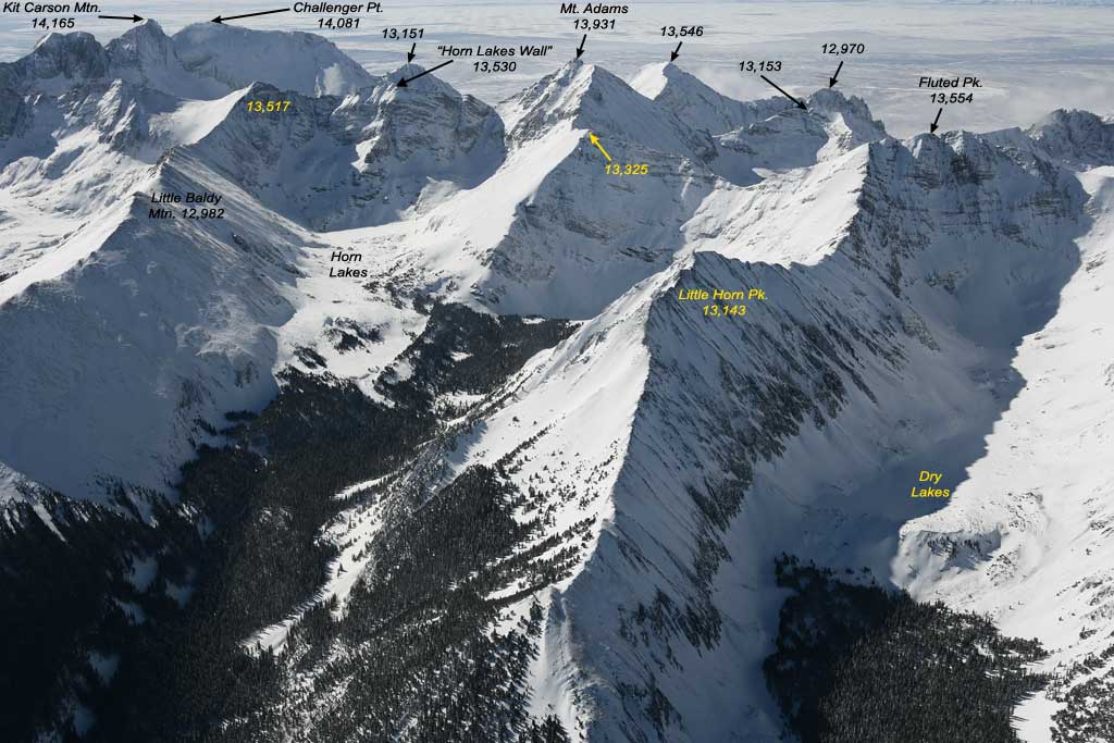
Kit Carson Mountain |
14165 / 4317 |
-105.603 , 37.980 | |
5 |
Challenger Point |
14080 / 4292 |
-105.606 , 37.980 | |
6 |
Humboldt Peak |
14064 / 4287 |
-105.555 , 37.976 | |
7 |
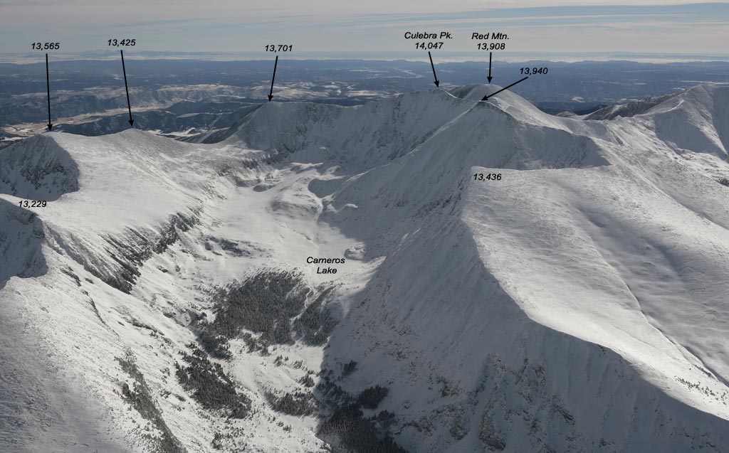
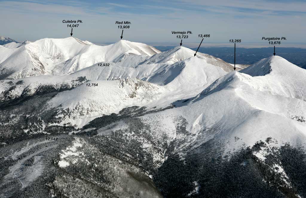
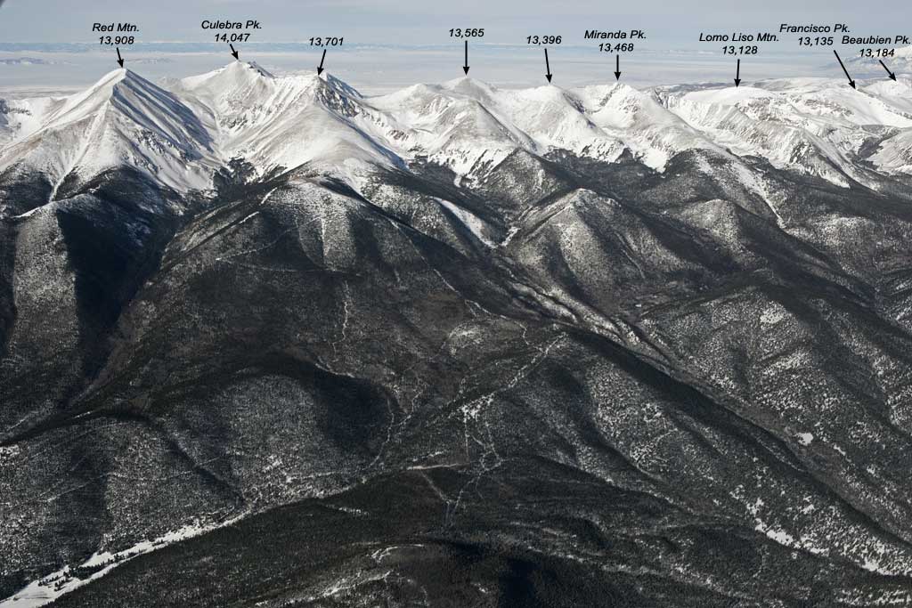
Culebra Peak |
14,047 / 4282 |
-105.186 , 37.122 | |
8 |
Ellingwood Point |
14,043 / 4280 |
-105.493 , 37.583 | |
9 |
Mount Lindsey |
14042 / 4280 |
-105.445 , 37.584 | |
10 |
Little Bear Peak |
14037 / 4278 |
-105.497 , 37.567 | |
11 |
Columbia Point |
13980 / 4261 |
-105.598 , 37.979 | |
12 |
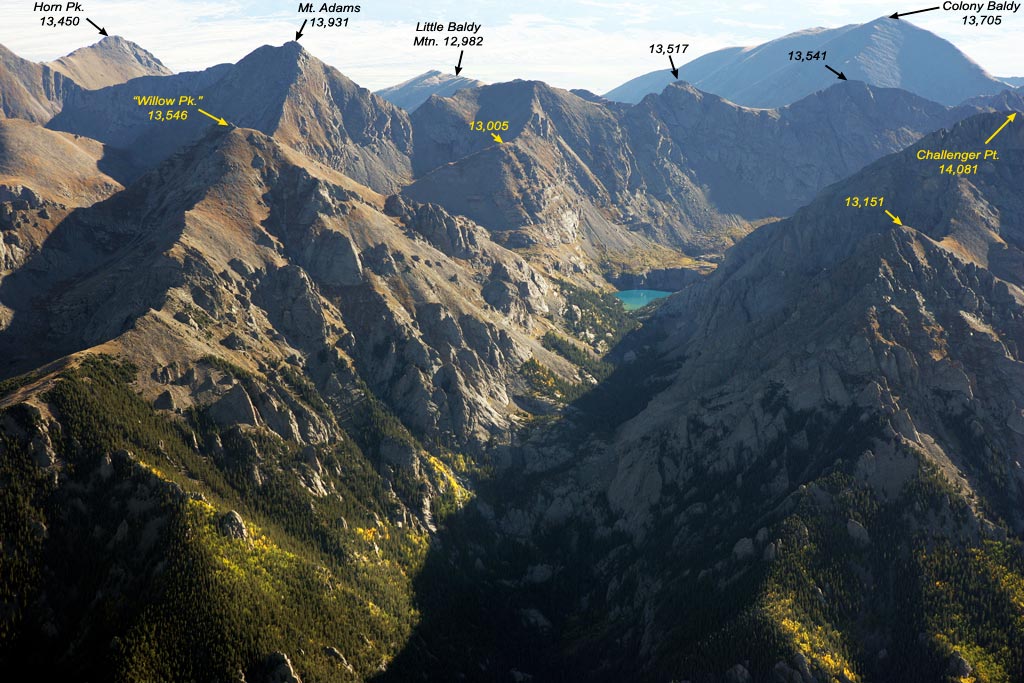
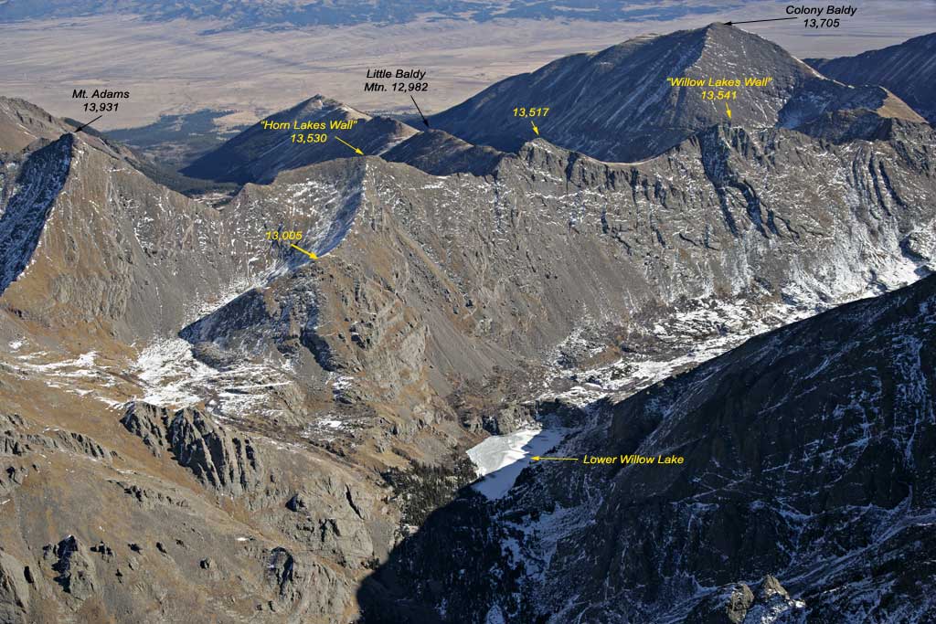
Mount Adams |
13941 / 4249 |
-105.605 , 38.007 | |
13 |
Red Mountain |
13908 / 4239 |
-105.181 , 37.112 | |
14 |
California Peak |
13849 / 4221 |
-105.499 , 37.614 | |
15 |
Huerfano Peak (Ute Peak). |
13828 / 4215 |
-105.448 , 37.600 | |
16 |
"Obstruction Peak" |
13799 / 4206 |
-105.588 , 37.978 | |
17 |
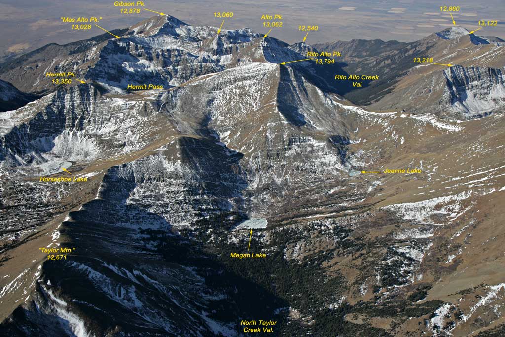
Rito Alto Peak |
13794 / 4204 |
-105.661 , 38.103 | |
18 |
Vermejo Peak |
13723 / 4183 |
-105.191 , 37.094 | |
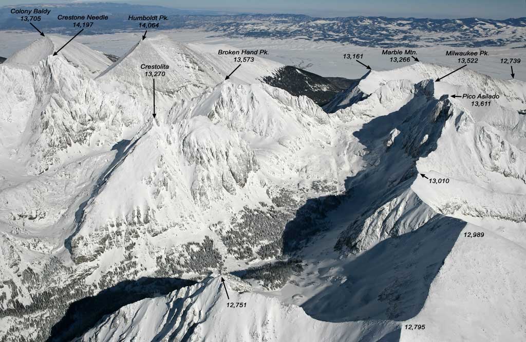
19 |
Colony Baldy |
13705 / 4177 |
-105.560 , 37.996 | |
20 |
Purgatoire Peak |
13676 / 4168 |
-105.211 , 37.072 | |
21 |
"Lily Peak" |
13660 / 4164 |
-105.501 , 37.600 | |
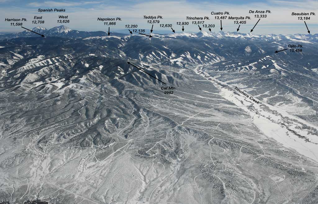
22 |
West Spanish Peak |
13626 / 4153 |
-104.994 , 37.376 | |
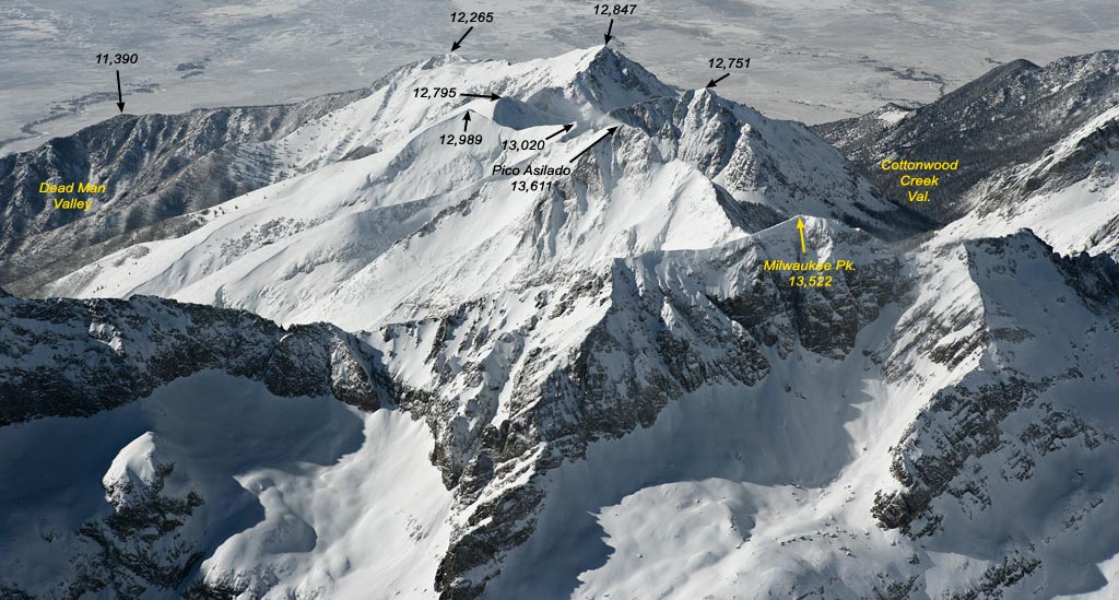
23 |
Pico Asilado |
13611 / 4149 |
-105.559 , 37.944 | |
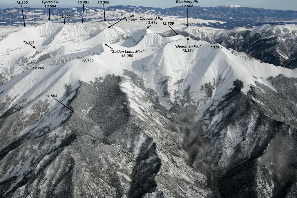
24 |
Tijeras Peak |
13604 / 4146 |
-105.540 , 37.924 | |
25 |
Electric Peak |
13598 / 4145 |
-105.708 , 38.182 | |
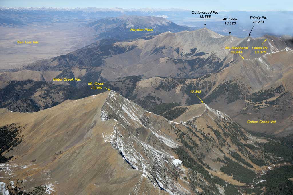
26 |
Cottonwood Peak |
13588 / 4142 |
-105.757 , 38.219 | |
27 |
Twin Peaks |
13580 / 4139 |
-105.519 , 37.590 | |
28 |
UN 13577 |
13577 / 4138 |
-105.493, 37.601 | |
29 |
Broken Hand Peak |
13573 / 4137 |
-105.756 , 38.219 | |
30 |
UN 13565 |
13565 / 4135 |
-105.176 , 37.140 | |
31 |
Fluted Peak |
13554 / 4131 |
-105.601 , 38.024 | |
32 |
Gibbs Peak |
13,553 / 4131 |
-105.666 , 38.164 | |
33 |
"Willow Peak" |
13546 / 4129 |
-105.619 , 38.003 | |
34 |
"Willow Lakes Wall" |
13541 / 4127 |
-105.592 , 37.992 | |
35 |
"Horn Lake Wall", UN13530/13517 |
13530 / 4124 |
-105.600 , 38.002 | |
36 |
Cloud Peak |
13524 / 4122 |
-105.657 , 38.118 | |
37 |
Milwaukee Peak |
13522 / 4122 |
-105.551 , 37.948 | |
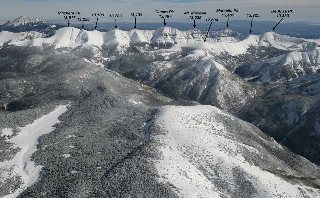
38 |
Trinchera Peak |
13517 / 4120 |
-105.165 , 37.289 | |
39 |
Silver Peak |
13513 / 4119 |
-105.670 , 38.129 | |
40 |
Eureka Mountain |
13507 / 4117 |
-105.641, 38.079 | |
41 |
Mount Marcy |
13490 / 4112 |
-105.676 , 38.146 | |
42 |
"Kolkman Peak" |
13490 / 4112 |
-105.685 , 38.121 | |
43 |
Cuatro Peak |
13487 / 4111 |
-105.155 , 37.258 | |
44 |
"Alamosito" |
13466 / 4104 |
-105.209 , 37.084 | |
45 |
Horn Peak |
13450 / 4100 |
-105.586 , 38.039 | |
46 |
Spread Eagle Peak |
13423 / 4091 |
-105.644 , 38.125 | |
47 |
Cleveland Peak |
13414 / 4089 |
-105.543 , 37.904 | |
48 |
Marquita Peak |
13405 / 4086 |
-105.153 , 37.238 | |
49 |
UN 13401 |
13401 / 4085 |
-105.542 , 37.912 | |
50 |
"Deadman Peak" |
13384 / 4079 |
-105.555 , 37.896 | |
51 |
Music Mountain |
13380 / 4078 |
-105.549 , 37.937 | |
52 |
Lakes Peak |
13375 / 4077 |
-105.727 , 38.200 | |
53 |
De Anza Peak North |
13362 / 4072 |
-105.687 , 38.167 | |
54 |
Mount Herrard (Mt. Seven) |
13350 / 4069 |
-105.495 , 37.849 | |
55 |
Hermit Peak |
13350 / 4069 |
-105.655 , 38.091 | |
56 |
Mount Owen |
13340 / 4066 |
-105.714 , 38.139 | |
57 |
Venable Peak |
13334 / 4064 |
-105.630 , 38.055 | |
58 |
De Anza Peak South |
13333 / 4064 |
-105.159 , 37.224 | |
59 |
Comanche Peak |
13277 / 4047 |
-105.615 , 38.043 | |
60 |
"Crestolita" |
13270 / 4045 |
-105.575 , 37.955 | |
61 |
Marble Mountain |
13266 / 4043 |
-105.533 , 37.955 | |
62 |
Spring Mountain |
13244 / 4037 |
-105.618 , 38.053 | |
63 |
"Bernardino Peak" |
13229 / 4032 |
-105.184 , 37.146 | |
64 |
Eagle Peak |
13205 / 4025 |
-105.722 , 38.229 | |
65 |
UN 13203 |
13203 / 4024 |
-105.160 , 37.275 | |
66 |
Beaubien Peak |
13184 / 4018 |
-105.166 , 37.197 | |
67 |
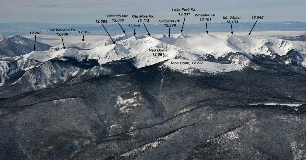
Wheeler Peak |
13161 / 4011 |
-105.417, 36.557 | |
68 |
"Medano Peak" |
13153 / 4009 |
-105.492 , 37.862 | |
69 |
"Crestone Lakes Peak" |
13153 / 4009 |
-105.615 , 38.013 | |
70 |
Little Horn Peak |
13143 / 4006 |
-105.584 , 38.025 | |
71 |
Francisco Peak |
13135 / 4004 |
-105.166 , 37.182 | |
72 |
Lomo Liso Mountain |
13128 / 4001 |
-105.173 , 37.172 | |
73 |
"4 K Peak" |
13123 / 4000 |
-105.745 , 38.214 | |
74 |
"Cherry Peak" |
13122 / 4000 |
-105.707 , 38.117 | |
75 |
Bushnell Peak |
13105 / 3994 |
-105.889 , 38.341 | |
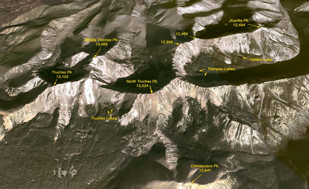
76 |
Truchas Peak |
13102 / 3993 |
-105.645, 35.963 | |
77 |
UN 13081 |
13081 / 3987 |
-105.464 , 37.585 | |
78 |
Hunts Peak |
13071 / 3984 |
-105.945 , 38.383 | |
79 |
Alto Peak |
13062 / 3981 |
-105.689 , 38.095 | |
80 |
"South Alto Peak" |
13060 / 3981 |
-105.689 , 38.089 | |
81 |
Pyramid Mountain |
13054 / 3979 |
-105.659 , 38.060 | |
82 |
Golden Lotus Mountain |
13050 / 3978 |
-105.559 , 37.907 | |
83 |
UN 13028 |
13028 / 3971 |
-105.681 , 38.081 | |
84 |
North Truchas Peak |
13024 / 3970 |
-105.632, 35.979 | |
85 |
UN 13020 |
13020 / 3968 |
-105.571 , 37.942 | |
86 |
"Twin Sisters" |
13012 / 3966 |
-105.902 , 38.352 |
A list made independently has been posted by Ryan Schilling. There are only a few differences in the mountain order because the USGS topo map did not list some of the mountain heights so that we've made an educated guesses.
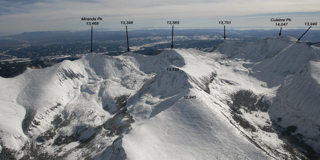
There are other well known 13-ers that are not listed in the Table because of too small prominence. They are: Hamilton Pk. (13,658, it is Blanca Pk. B), Miranda Pk. (13,468; UN 13565 B), Maxwell Pk. (13,335; Marquita Pk. B), Thirsty Pk. (13,213; Lakes Pk. B), Mt Walter (13,133; Wheeler Pk. B), Old Mike Pk. (13,113; Wheeler Pk. C), Middle Truchas Pk. (13,066; Truchas Pk. B).
For more listings of New Mexico Sangres (peaks 10k and above), please see John Kirk's page.
Colorado 14-ers, Colorado 13-ers, Colorado 12-ers,
Contiguous US Highest 150
![]()
© 2005-9 PikesPeakPhoto. All rights reserved.