 |
 |
 |
 |
|---|---|---|---|
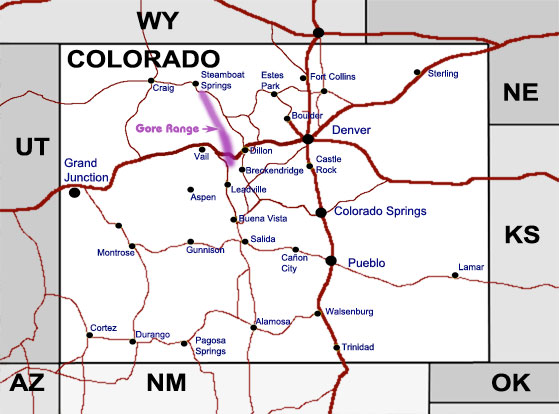
Location of Mosquito Range in Colorado |
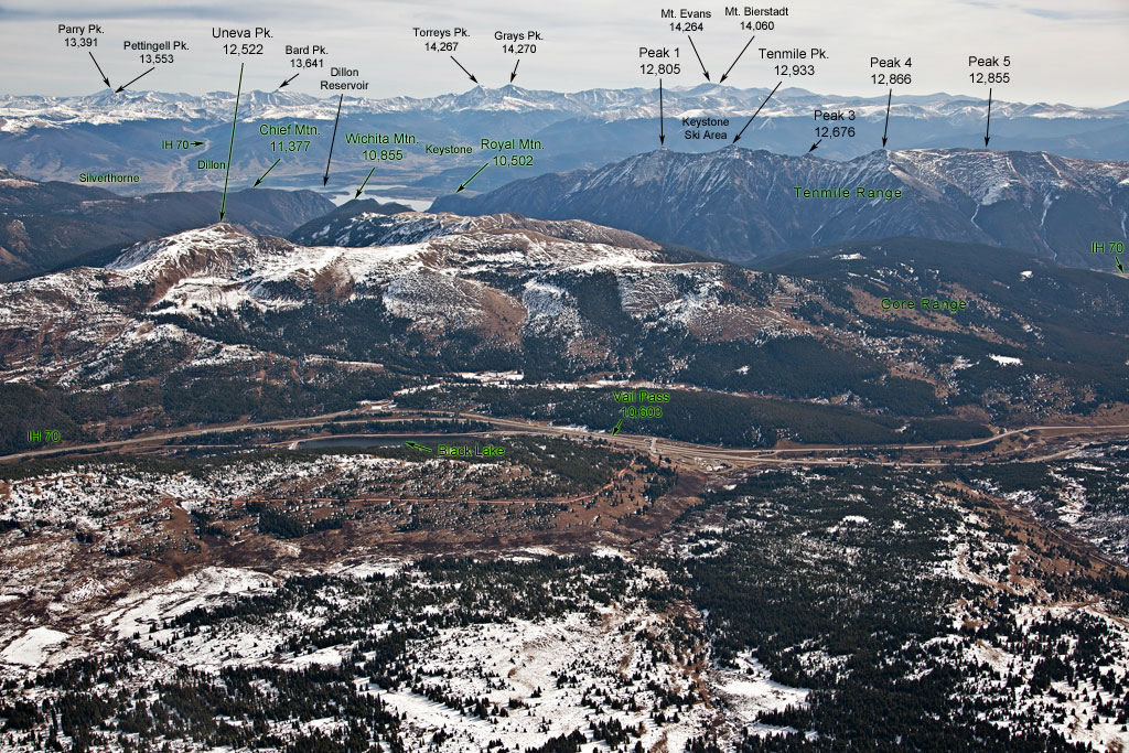
Western view of the Southern end of Gore Range with Uneva Peak |
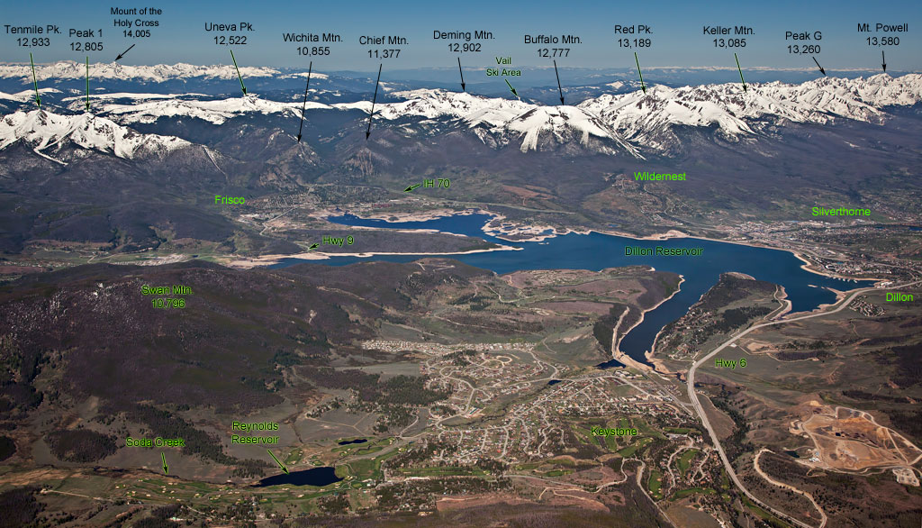
Dillon Reservoir vicinity showing most ot the top peaks in Gore Range |
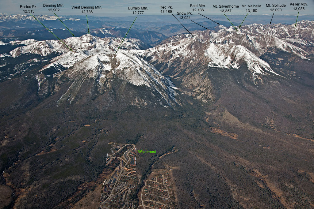
Buffalo Mountain and Red Peak |
 |
 |
 |
 |
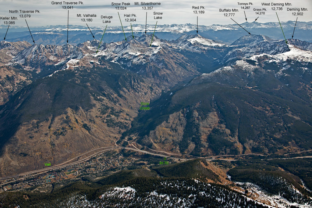
Vail and Gore Range |
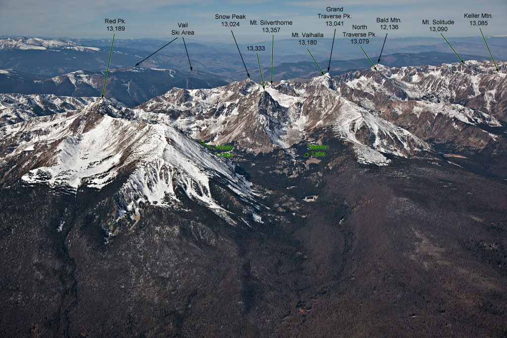
Mount Valhalla and North Traverse Peak |
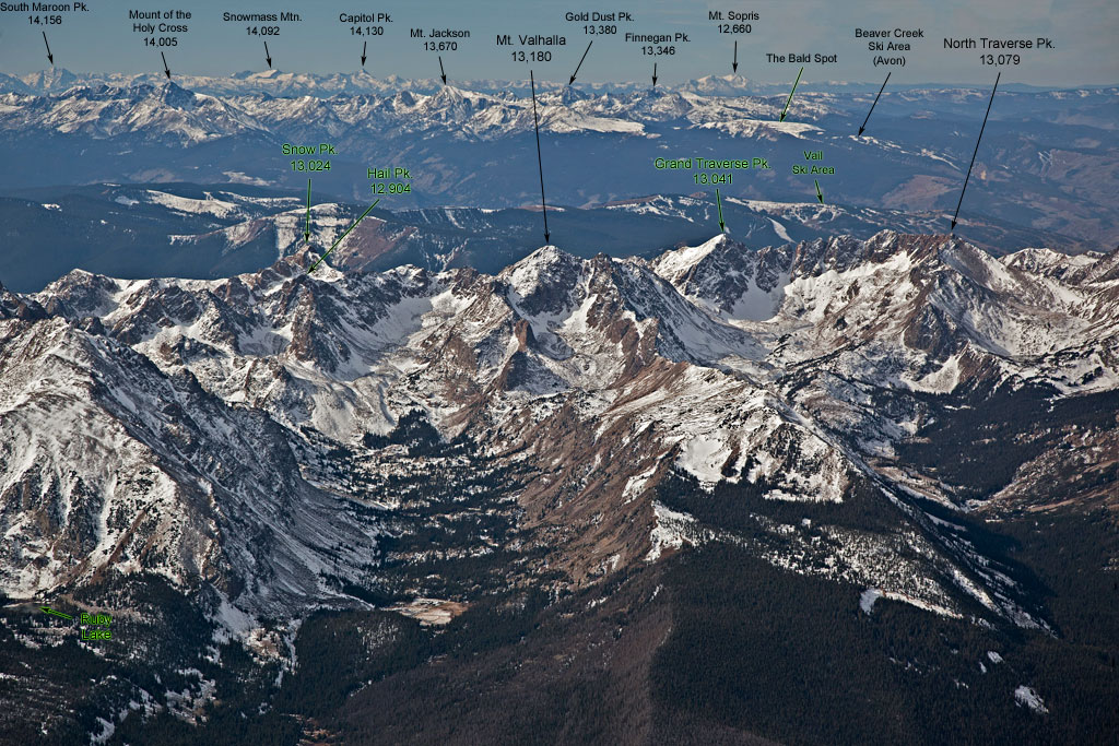
Mount Valhalla |
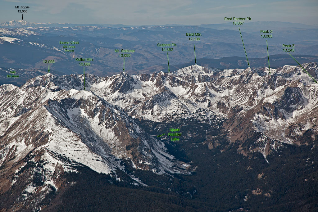
From Keller Mountain to Peak X |
 |
 |
 |
 |
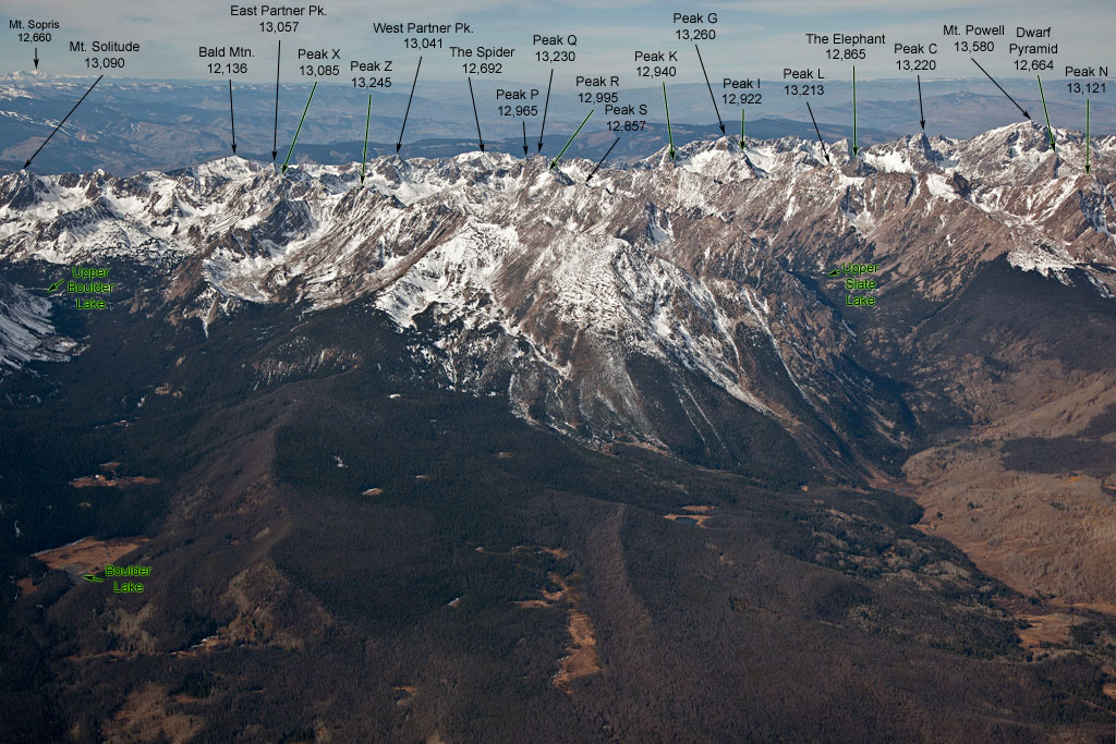
From Mount Solitude to Mount Powell |
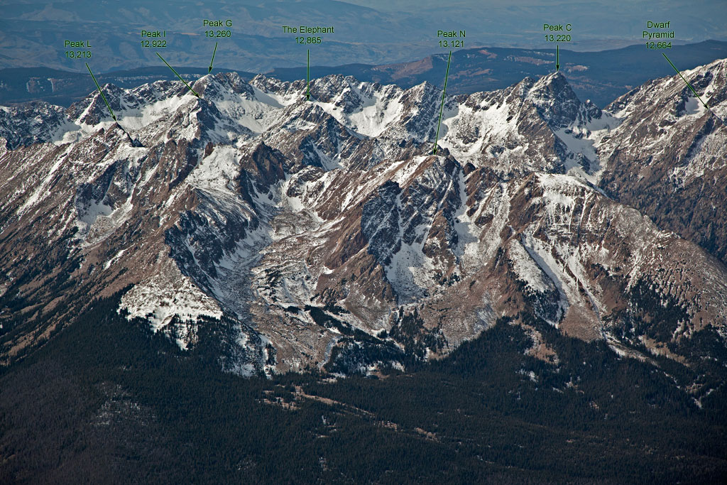
From Peak L to Dwarf Pyramid |
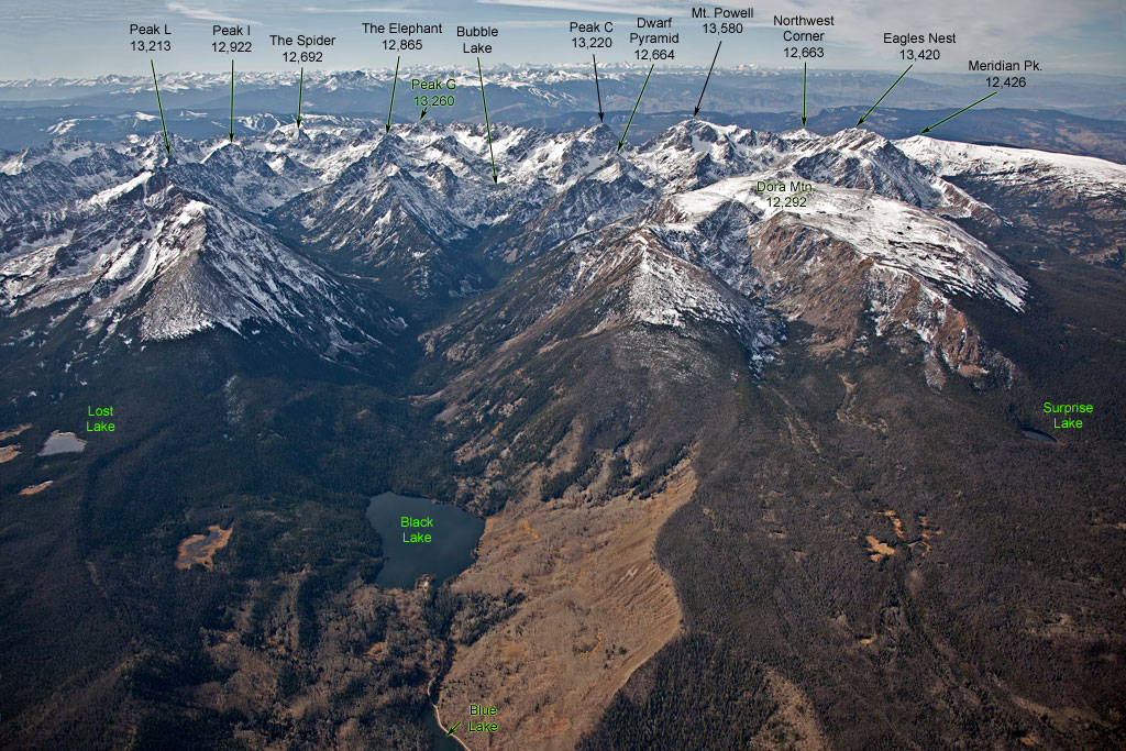
From Peak L to Eagles Nest |
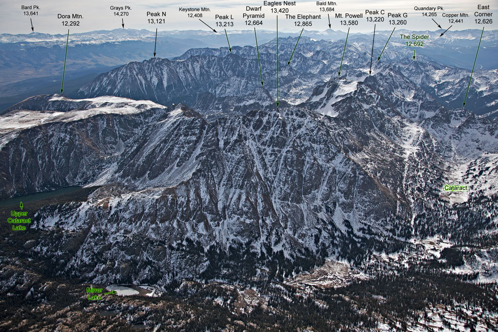
Eagles Nest, view to the south |

