Aerial Photographs with Mountain Descriptions from Pikes Peak to Longs Peak and Beyond
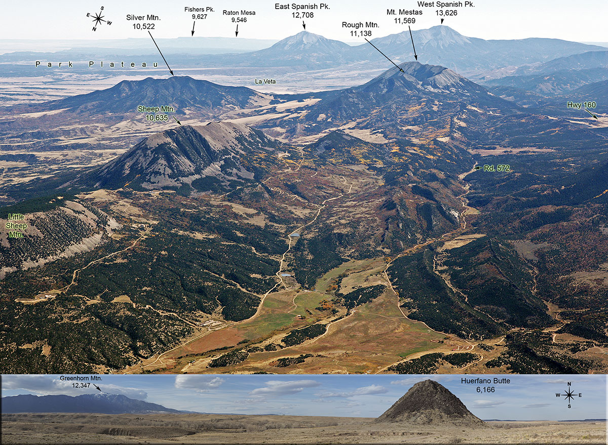
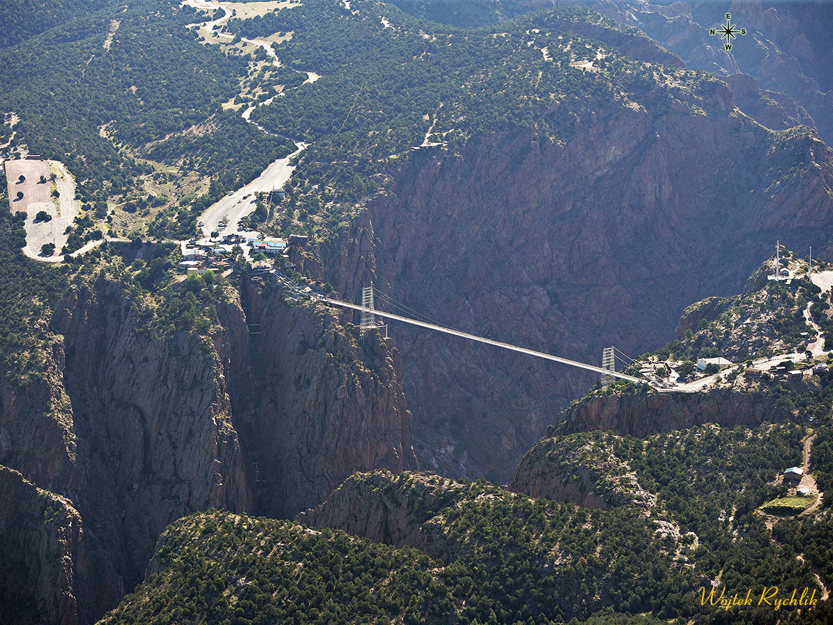
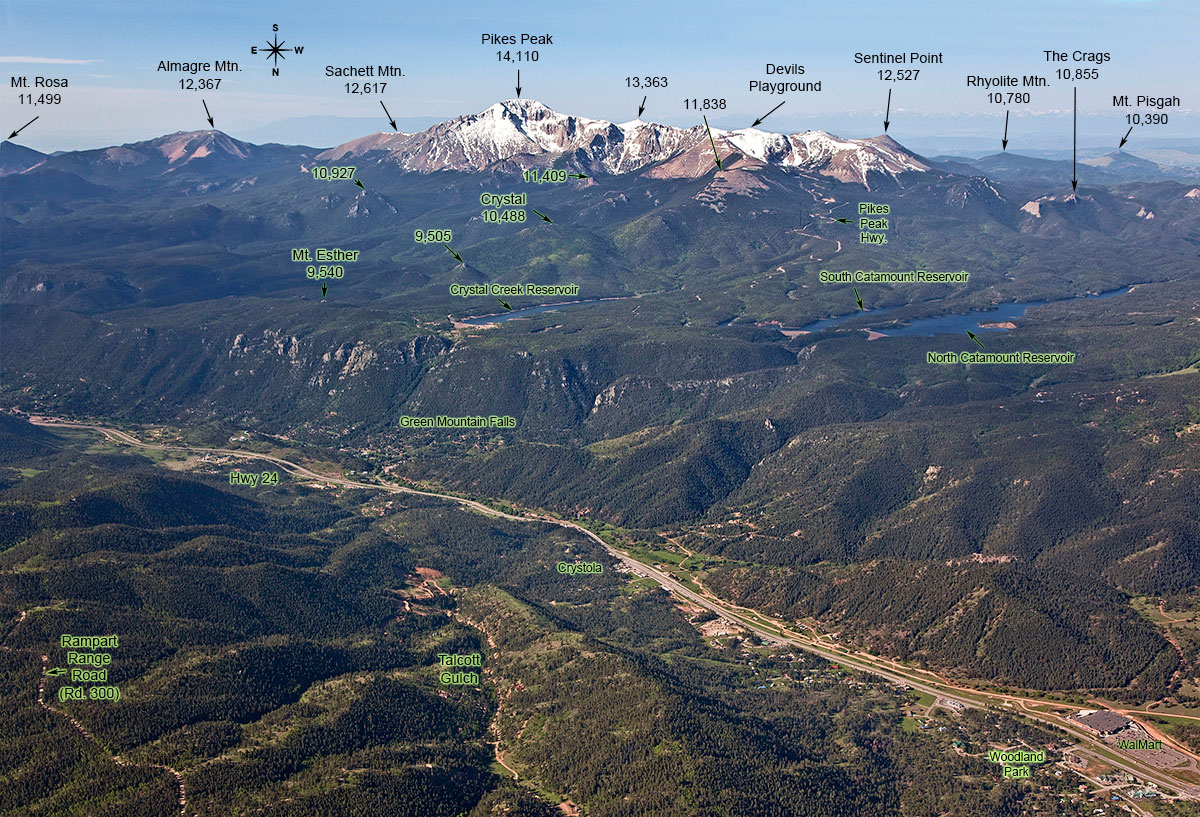
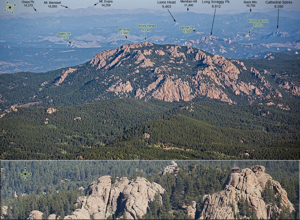
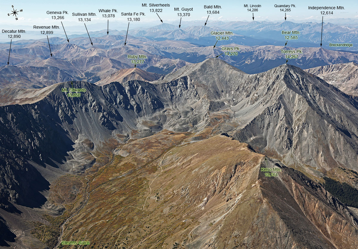
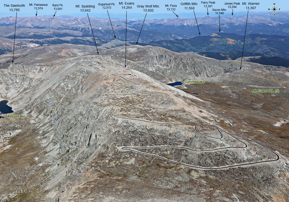
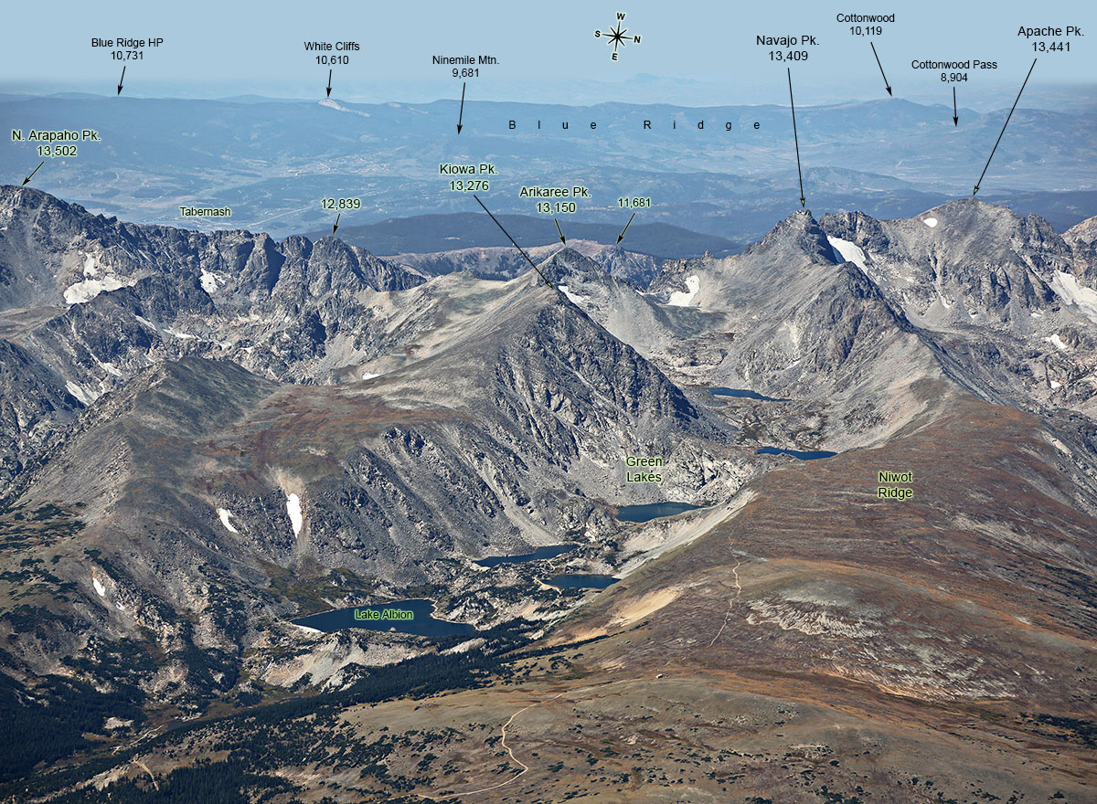
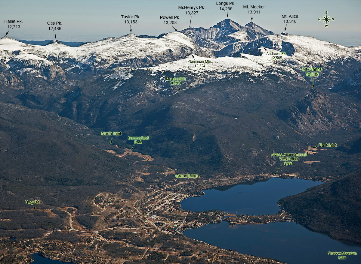
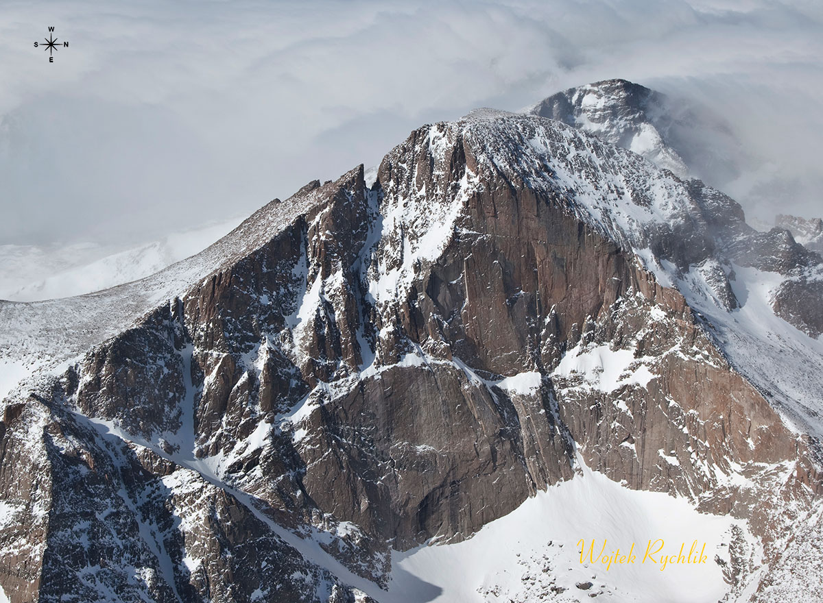
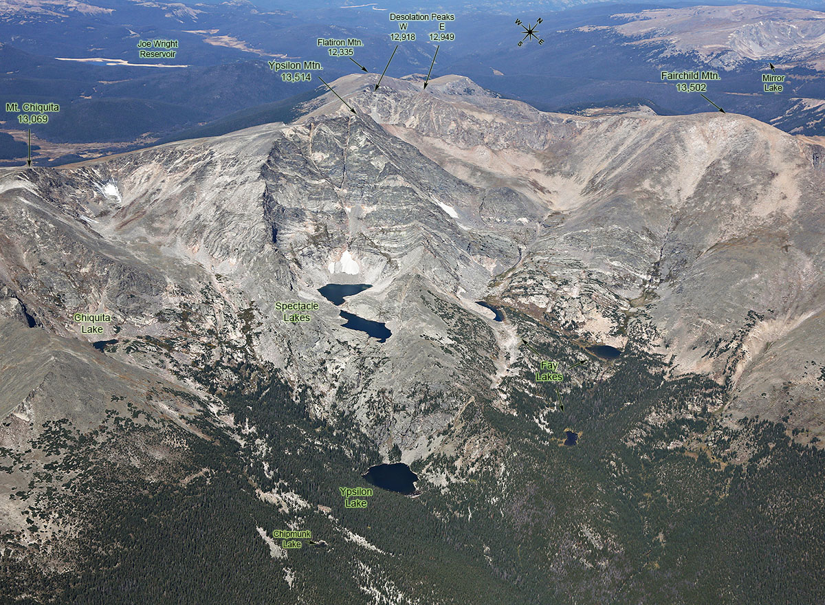
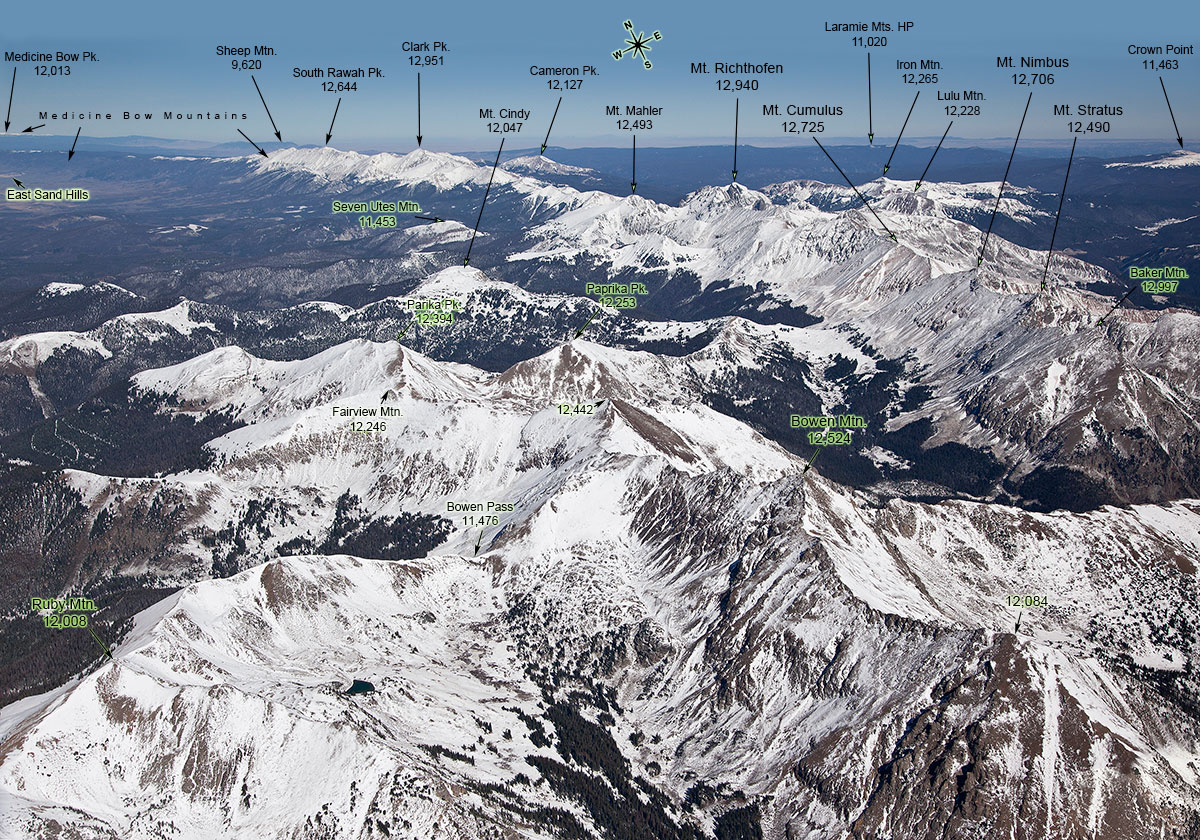
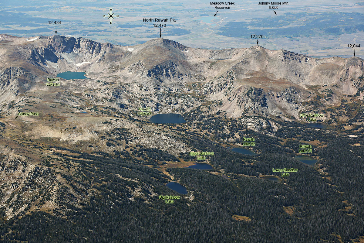
The Atlas contains 575, mostly aerial, photographs of the Front Range Mountains, supplemented with 9 USGS maps and a comprehensive index (1469 entries), a total of 572 pages. This is an eBook, available in .pdf format on a CD. Some of the images from this publication are presented on the right.
The disk contains the following files:
1. FR-eBook.pdf. A 687 MB file.
Publication info: ISBN 978-0-9842554-7-4
2. FR_front-cover.jpg, The front cover of the printed version book (not available in the eBook).
You may download a FREE evaluation copy of the eBook. It is saved in a highly compressed format, so that it is in a smallest possible size for download (caution: still 53 Megabytes), but the photos are of poor quality when viewed on full screen. To see the first 10 pages in the commercial format (maximum quality compression) click here.
The CD is available for $9.90 ($6 S&H). Please contact me if you have any questions or proceed to the ORDER page.